
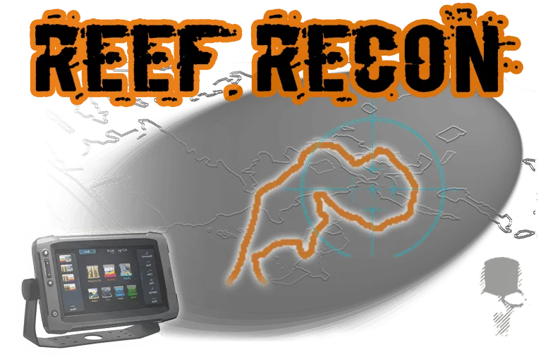
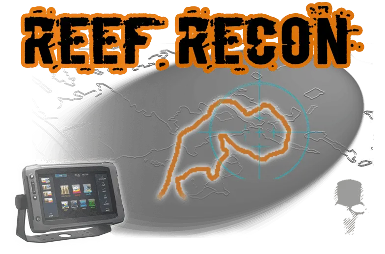
Galveston Bay Reef Recon
$199.00
Quantity
Reef Recon is an overlay for your GPS unit showing the boundaries of all reefs in the Galveston Bay Complex. It includes both shallow and deep reefs.
Why Was It Made?
Formerly oyster reefs were identified on maps by single waypoints. With Reef Recon (TM) you can see the entire reef boundary and know exactly where you are in relation to the entire reef. If you want to fish the edge of it, you can do that. If you want to stop your drift at the true end of it, you can do that. If you want to start your drift at the edge of it, ... you get the picture.
The file is easily imported into your GPS unit via an SD card. It’s designed to work in conjunction with any base map whether it is your unit’s stock basemap or a third party base map upgrade such as Navionics and others. It can also be used standalone without a base map if your unit does not project a map.
Note: The file is a download available immediately after purchase. If you want a preloaded SD card there is a service and shipping fee - contact [email protected] to arrange for preloaded chip.
Reef Recon is Registered Copyrighted Work- 2018
All Rights Reserved - Precision Fishing Resources LLC TroutSupport.com
West Bay
Bastrop Bay
Chocolate Bay
Greens Lake
Galveston Bay
Moses Lake
Tabbs Bay
Trinity Bay
Christmas Bay
Oyster Bay
Carancahua Lake
Jones Bay (Excludes Swan Lake)
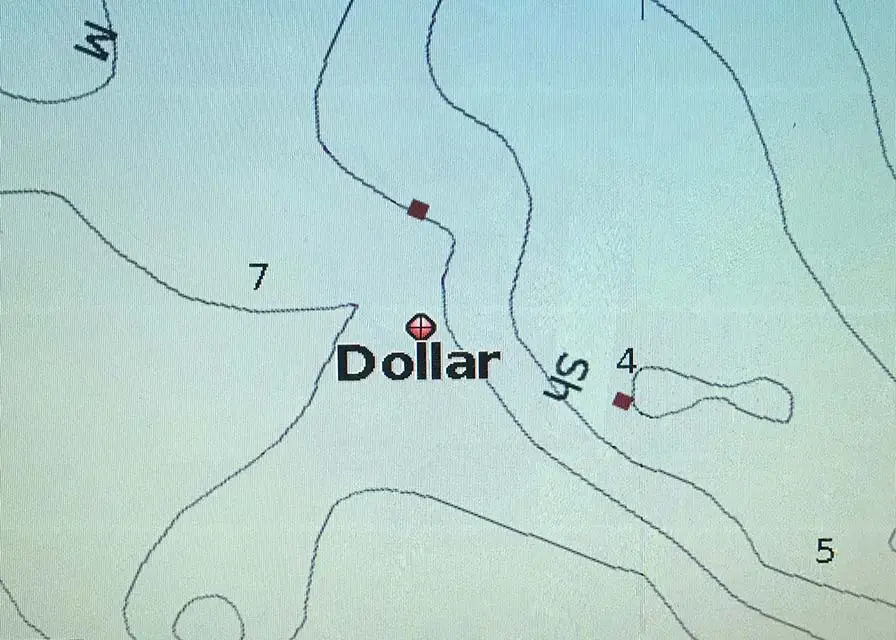
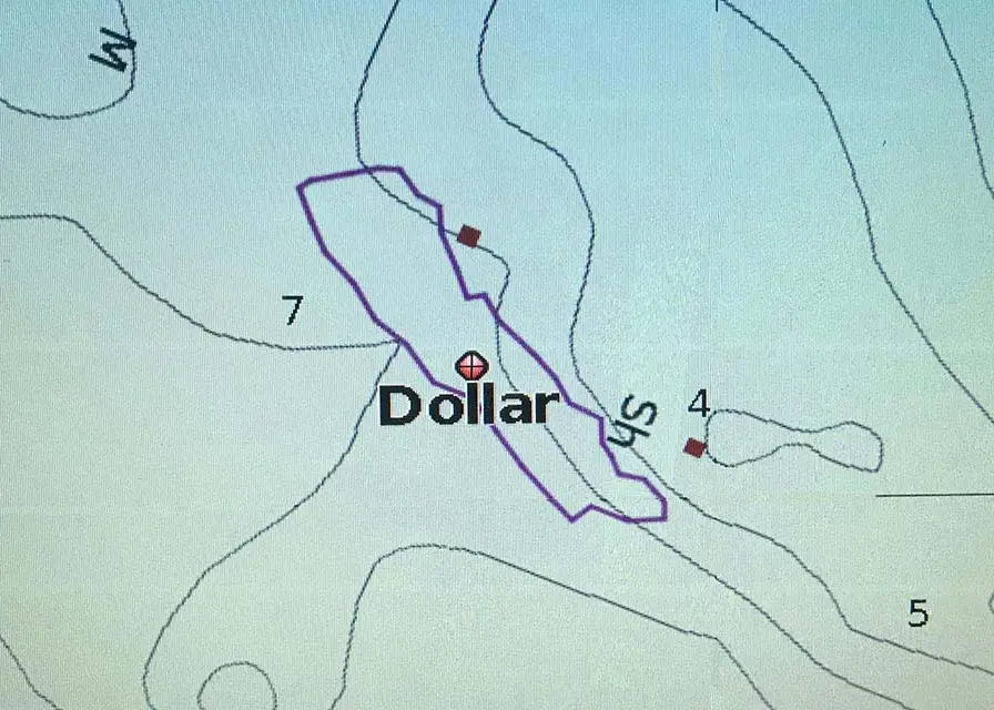
Dollar Bay
Dickinson Bay
Upper Galveston Bay (to 146 Bridge)
(Excludes Clear Lake)
East Bay (Deep Reefs Only)
West Bay
Oyster Bay
Greens Lake
Dollar Bay
Tabbs Bay
East Bay (Deep Reefs Only)
What you see on YOUR GPS
What you see with REEF RECON
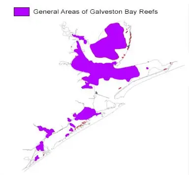
Map Coverage Area
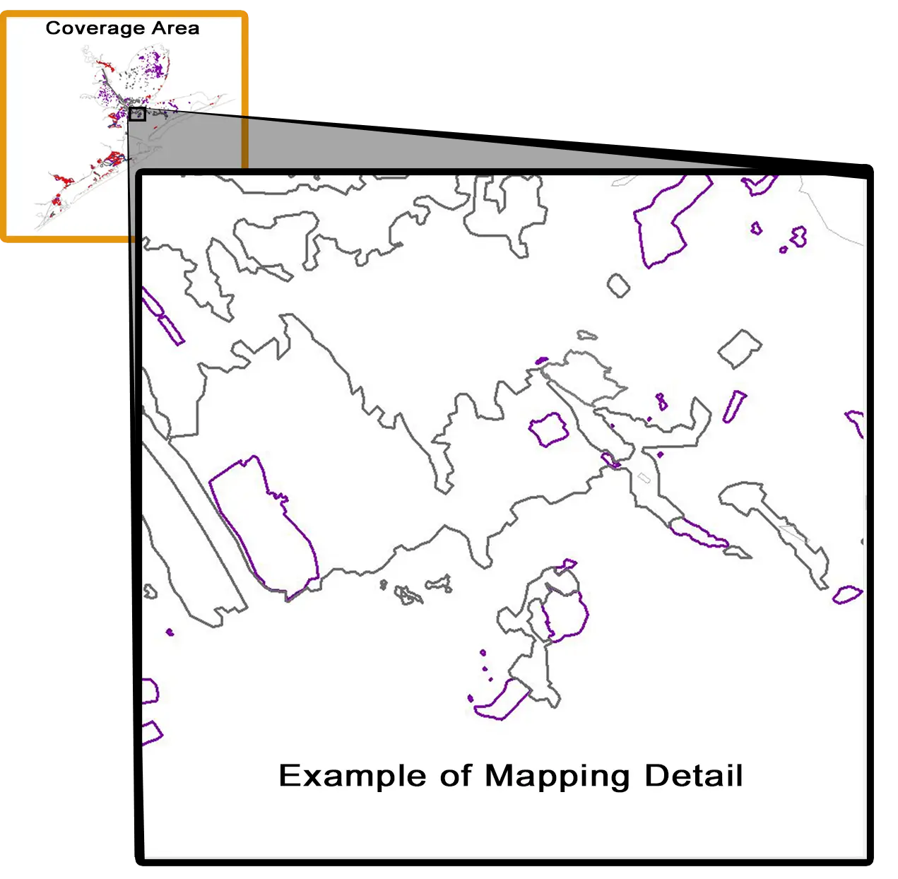
Example - Level of Detail of Mapping on REEF RECON
The file is easily imported into your GPS (Currently only for Lowrance, Simrad, Humminbird, Garmin and Raymarine chartplotters and some handheld Garmin and devices via an SD or micro sd card. It’s designed to work in conjunction with any base map whether it is your unit’s stock basemap or a third party base map upgrade such as Navionics, Standard Mapping, and others. It can also be used standalone without a base map if your unit has a suitable basemap.
Lowrance
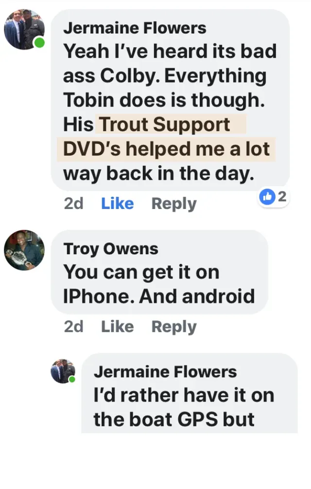
HDS Pro
HDS Live,
HDS Carbon
HDS (Gen 1,2,3)
Elite
Elite Combo
Elite Ti2
Elite FS
Hook
Hook 2
Hook Reveal
Mark IV
Mark V
LMS
LCX
NOTE: Models without GPS and Map are not
compatible
ALL Lowrance models that have GPS and a
Map are compatible.
Simrad
NSS 4
NSS Evo 3
NSS Evo 2
GO XSE
GO
NSO
NSE
NSS
Cruise
NSXX not Suported
Garmin
EchoMAP (all sizes and series)
GPSMAP (all sizes and series)
Raymarine
LightHouse 2 (LH 3 is not supported)
Hand Held Garmin
GPS 73 (all versions)
GPS 76 (all versions)
GPS 78 (all versions)
GPS 79 (all versions)
GPS 86 (all versions)
Oregon
Montana
Colorado
HummingBird
Helix
Onyx
999 / 899
If you are not sure if your unit is compatible just email us or submit a support tickets
Benefits
Knowing the locations, size, and edge locations would literally be worth decades of on the water experience.
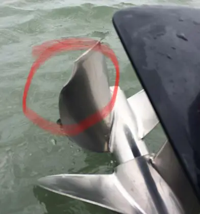
Knowing where shallow dangerous reefs are could save your hulls gelcoat, and probably even at least one prop repair or more
Having numerous other options when getting to your chosen location only to find someone already fishing it.
Knowing which sets of PVC pipes have no oyster at all, and knowing where exactly the best shell is on all reefs marked and unmarked.
Don’t scan for reefs... use your precious time to fish and have fun.
What Anglers Say About Our Reef Recon
Discover how Reef Recon™ changed the way they fish oyster reefs.


FAQ (Frequently Asked Questions)
Doesn't my third party GPS chip already have the reefs?
No. While the majority of third party map chips are suitable for general information and a great starting point for depths, they do not show you the outlines of ALL reefs in the bays. We like third party maps and decided REEF RECON should overlay their work so you have the best of both worlds.
I just bought a new GPS unit and got the structure scan, can't I scan the reefs myself a little at a time?
Yes. By all means continue to scan reefs. It's a great way to learn how to use your sonar / GPS. However, it took us a 18 months of full time scanning (week in and week out; including weekends), thousands of dollars of technology, and thousands more in fuel, and more in software cost. Not to mention the time it took away from our families and our valuable recreation and fishing time which was almost zero. REEF RECON allows you the freedom to ' GO fish!'
Can't I just go fish where the PVC pipes mark the Oyster leases?
Yes. However, the nearly 8 year drought decimated much of the oyster leases and there ARE leases with PVC pipes with NO remaining oyster substrate. REEF RECON gives you options if a boat is on a reef you wanted to go to, you can just go to another reef and know exactly the size, shape, and layout of the reef on your chartplotter and see where you are on it. If you hear the fish are in a certain part of the bay, you can go hit those reefs. It takes a lot of guesswork out of the equation.
Can I use it over my existing chip/card?
Yes. You'll import the REEF RECON file into your unit and then place the third party map chip/card back into the unit. REEF RECON will overlay on top of the map you are using, and if you already have hot spot type waypoint maps it works great with that as well.
I already have 2 chips filling both slots, is there some way to also install Reef Recon even though they are filled?
Yes. Simply remove one of the cards temporally to install the file. Once Reef Recon is installed return the card to the slot. Works great you'll love it.
Will I recieve the product as an sd card 'chip' like or other mapping cards?
The product is a digital download available immediately after purchase. You will be emailed instructions on how to download and move the file to a SD or MicroSD card for your unit. If you'd like a preloaded card we can supply that to you for $35 + tax and shipping. If you would like the conveinience of a preloaded card contact [email protected]
Our Happy Customers
“ Went out of my neighborhood in Galveston (on the bay). Hit some of the reefs that were marked on your Reef Recon file. (Red) reefs that I knew existed, but never could really locate, even with satellite imaging. These fish were mostly caught on the North end of the reefs in less than 2’ of water. It’s to the point now that I’ll literally shut the boat down, and troll up to the edges of the shell and target the points. I don’t always catch, but when I do, I find them STACKED!! I know you’ve heard it 1,000 times, but this program is a GAME CHANGER!!! It’s to the point where I only have to fish within 15-20 mins from the house. I can now go hit certain reefs before work and still be on time at 9 am. Thank you for ALL the time spent on the water to offer such an incredible data for everyday fishermen like myself. No more having to go grind it out looking for the best habitat, I just use Reef Recon!!!
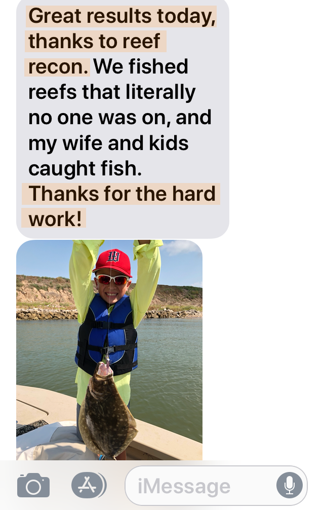
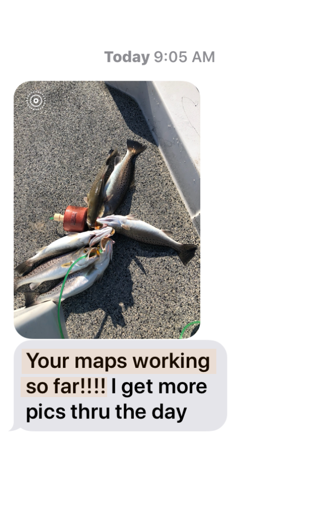
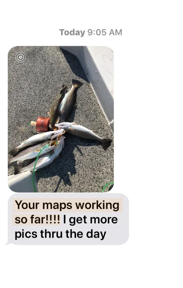
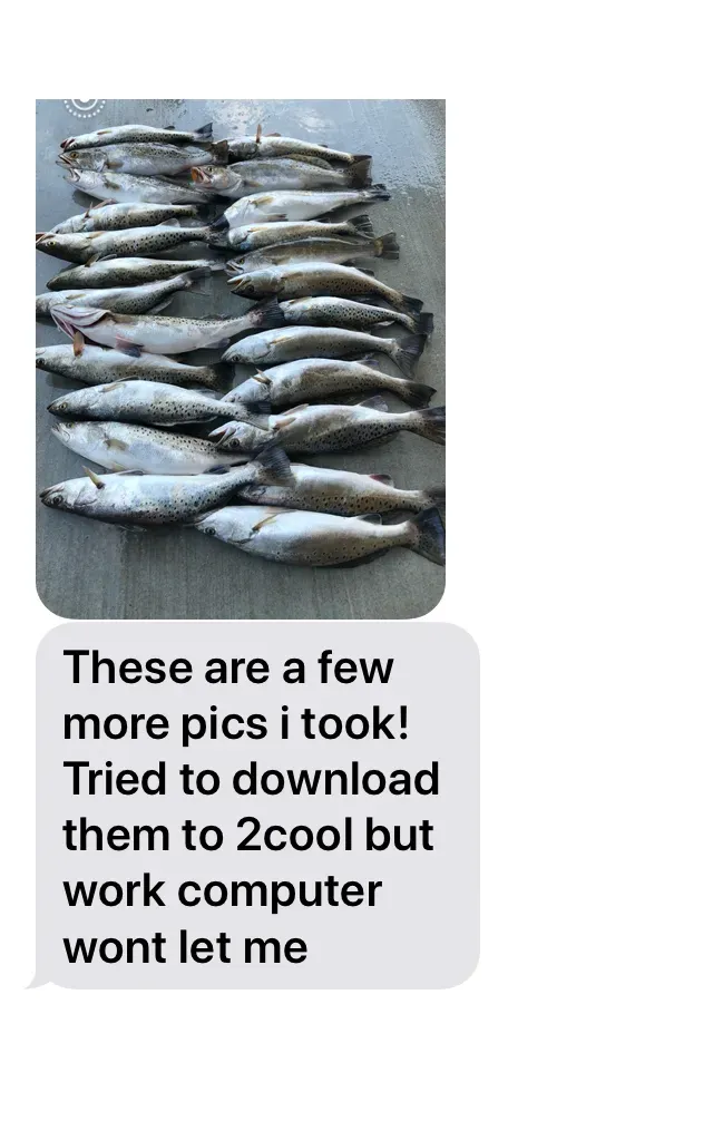
“ This tool is great! Allows you to find the edge of reefs quickly! It works! Thank you so much for you effort in building this. Here are some pics from my first time out using Reef Recon last Sunday morning. Very pleased; money well spent sir! ”
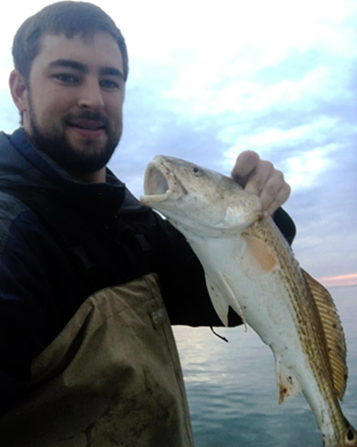
“ Caught this fish somewhere I never would have gone without Reef Recon; I only had an hour but really happy with it "

Copyright 2026. Precision Fishing Resources LLC.
All Rights Reserved.
Products
Company
Support/Info
Sign up for fishing tips and updates.